
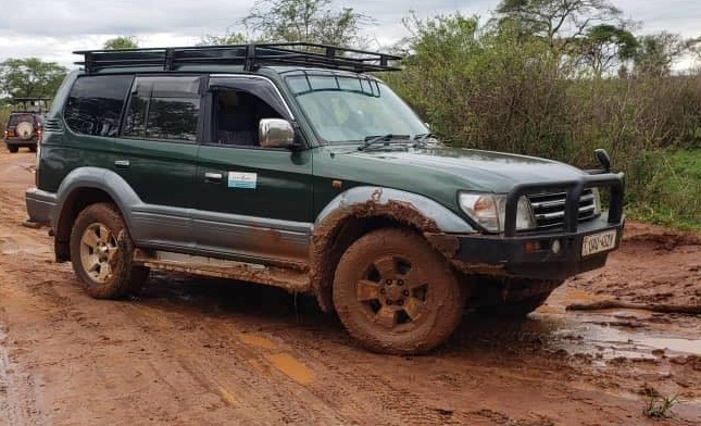
Bwindi Impenetrable National Park is located in southwestern Uganda’s mountainous rift valley region. Accessing its four gorilla trekking sectors—Buhoma, Ruhija, Rushaga, and Nkuringo—involves navigating steep, winding murram (unpaved gravel) roads that require a high-clearance 4×4 safari vehicle.
Sector-by-Sector Access Breakdown
1. Buhoma Sector (Northern Bwindi)
Buhoma is the most straightforward sector to reach. Main highways from Kampala to Rukungiri are fully paved. The remaining 40 km section from Kihihi to Buhoma is unpaved murram with loose gravel, potholes, and occasional muddy patches during rains. Buhoma is also accessible from Queen Elizabeth National Park’s Ishasha sector via an unpaved safari corridor.
2. Ruhija Sector (Eastern Bwindi)
Ruhija is positioned in high-altitude terrain on the eastern side of Bwindi. Access is via Kabale along a winding, steep murram road characterized by sharp bends, loose stones, and erosion ruts. During rainy weather, surfaces become slippery, requiring low-range 4WD engagement.
3. Rushaga Sector (Southern Bwindi)
Rushaga is reached via Kabale or Kisoro. While the main highway connecting Kabale to Kisoro is paved, the branch-off road into Rushaga consists of hilly murram with steep gradients. Extra care and high ground clearance are mandatory.
4. Nkuringo Sector (Southern Bwindi)
Nkuringo sits on a high ridge overlooking the Virunga volcanoes. The final approach involves steep climbs, narrow bends, and rough unpaved mountain tracks. Heavy rains can cause mudslides or temporary delays. A heavy-duty Land Cruiser GX or Prado TX is strongly recommended.
Practical Driving Tips for Bwindi
- Use Low-Range 4WD: Engage 4WD mode before climbing steep muddy inclines.
- Avoid Night Driving: Mountain roads lack street lighting, feature sharp drop-offs, and may have unexpected fog or livestock on the road.
- Allow Extra Travel Time: Short geographic distances on map apps can take 3 to 5 hours due to winding mountain terrain.